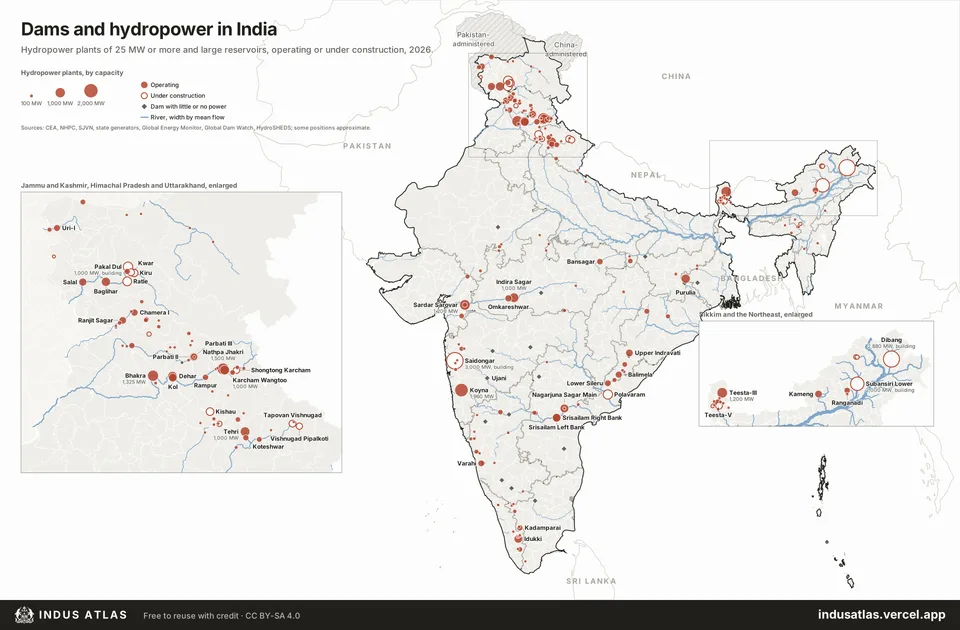
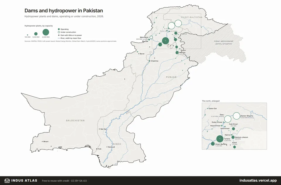
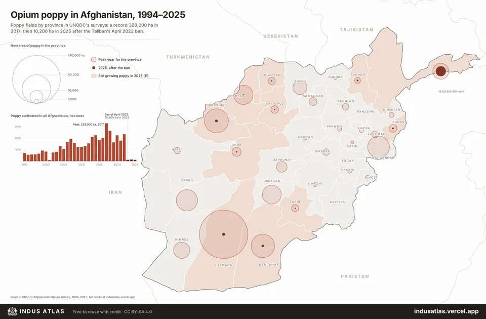
Maps of Pakistan, India and Afghanistan.
Census tables, casualty counts and official records, drawn as maps. Hover or tap for the numbers behind each one, and reuse any map with credit.
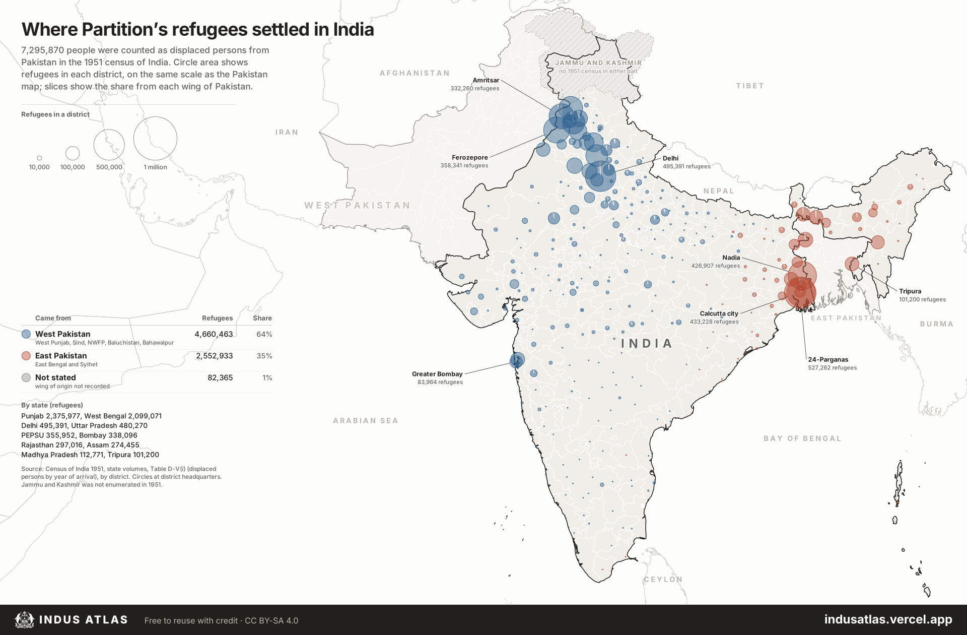
Map of the day
What the maps show
Three figures taken from the maps’ data.
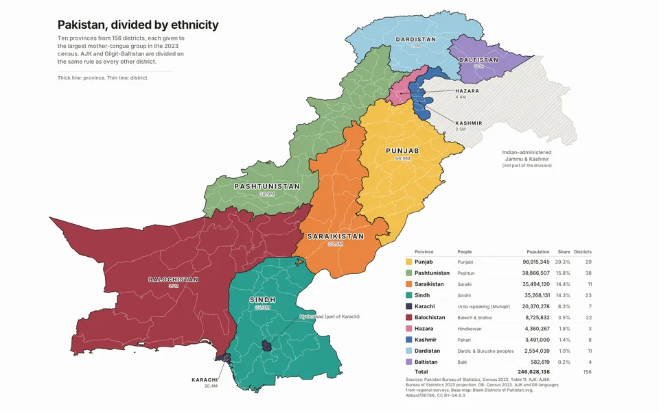
- 39%of Pakistan’s people live in the Punjabi-speaking province, the largest of ten.Map 1. Pakistan by mother tongue
- 11,094people killed in 1,322 major militant attacks in Pakistan from 2007 to 2014, the Taliban’s peak years.Map 12. Militant attacks in Pakistan, 2007–2014
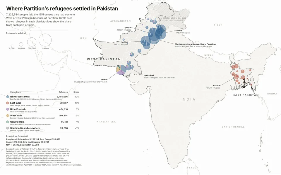
- 986,236refugees settled in Lyallpur district by 1951, more than in all of Sind.Map 14. Where Partition’s refugees settled in Pakistan
Census and identity
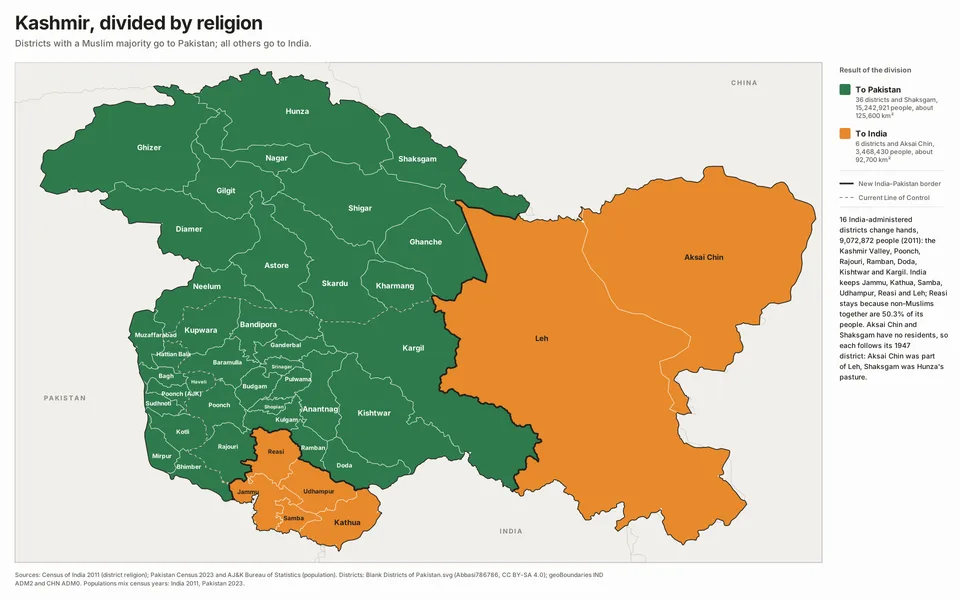
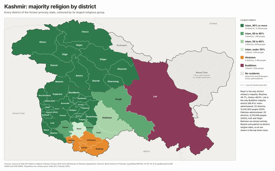
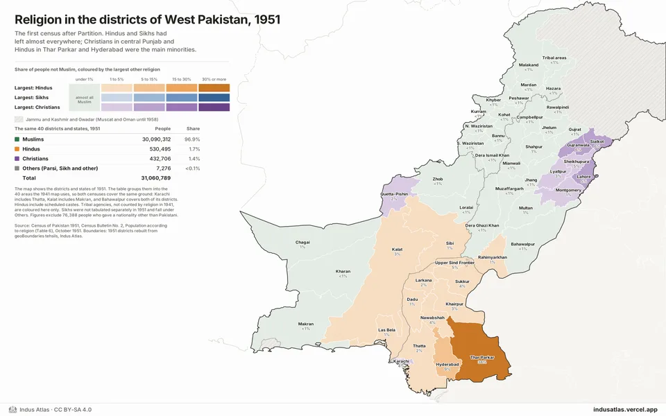
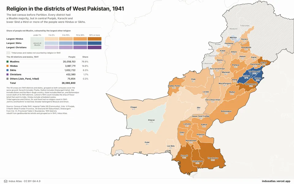
Language and religion, district by district.
Conflict
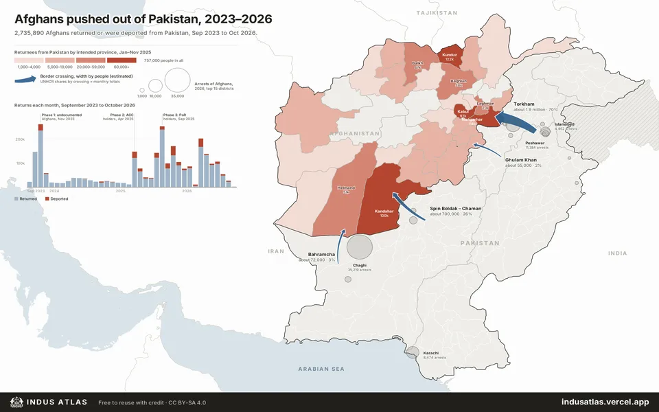
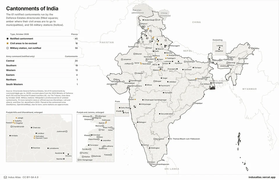
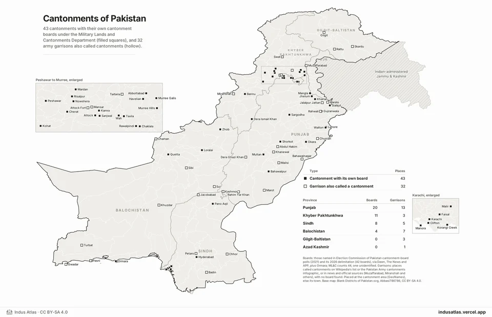
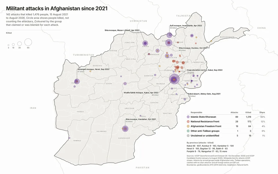
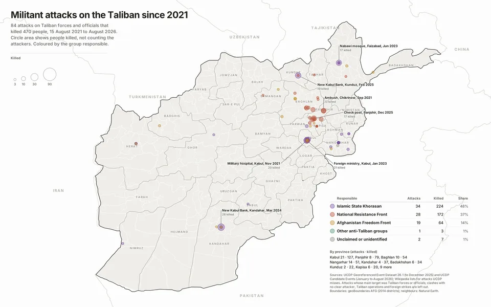
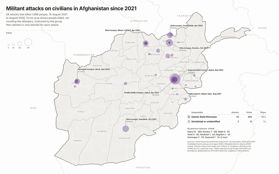
Militant attacks, military operations, garrisons and displacement.
Partition and history
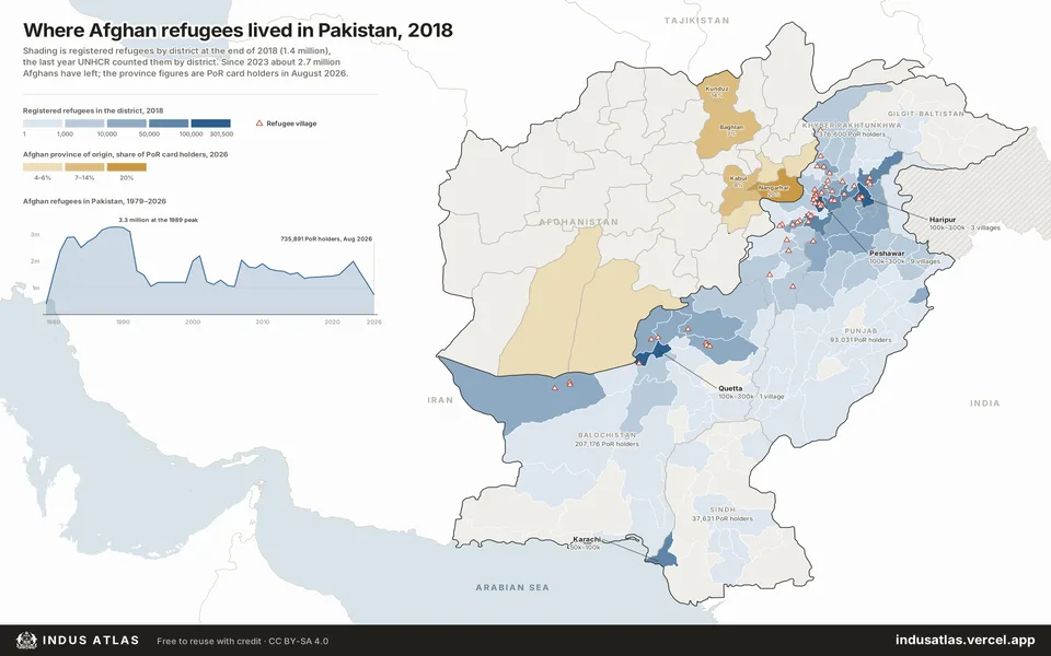
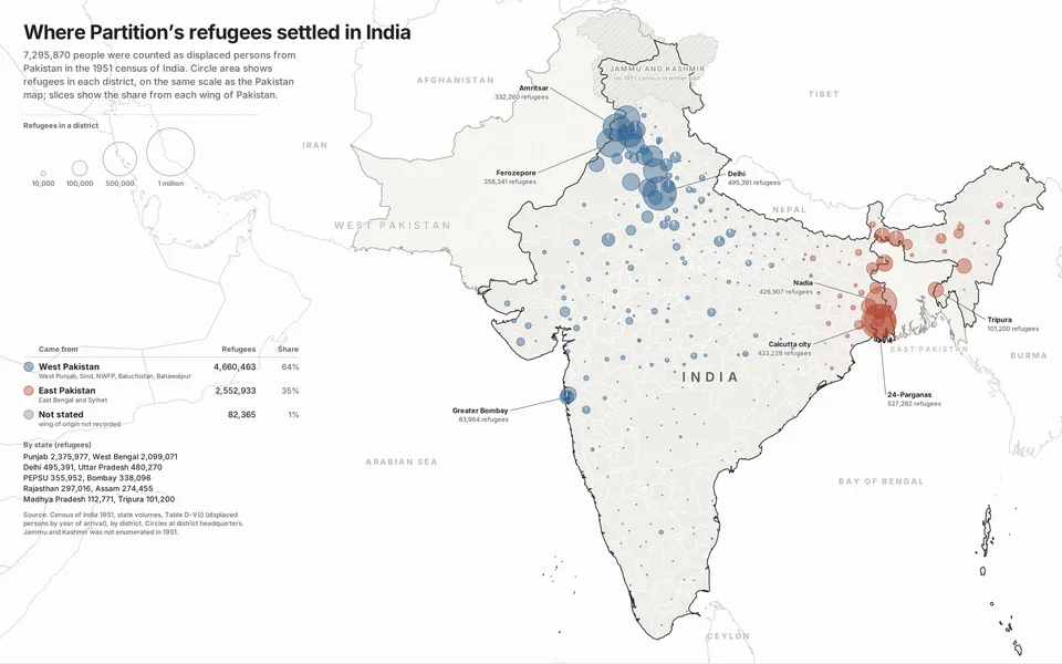
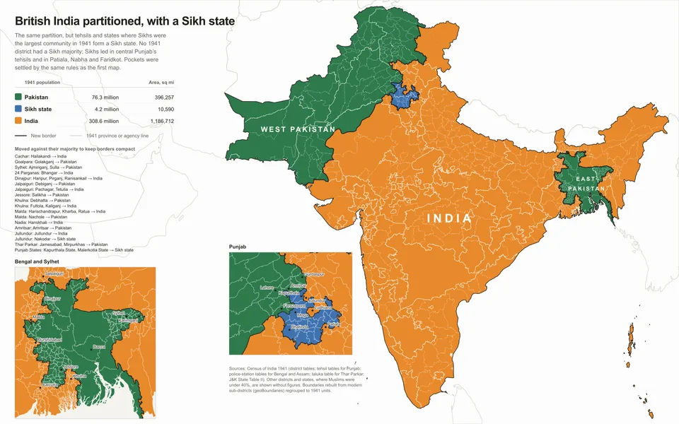
Partition, the refugees it created, and how the population changed.
Land and resources
Dams, hydropower and how the land is used.